Oaklands was 500 acres of sheep farm originally owned by the parents of Elizabeth Williams, (Harold and Elsie Main) purchased by Clive Williams and run as an Angus beef cattle farm / stud.
The 500 acres was made up of two blocks that were divided off from land owned by the Mains plus land subsequently purchased by Clive and Elizabeth from Bayleys.
Harold Main owned the 350 acres on the Western side of Oaklands. This side contained the original homestead, sheep shearing shed and horse stable / barn.
This itself was a part of the original 800 acres purchased by his father William Main and was a part of the “Matamata Estate”. The “homestead” was originally the shepherd’s cottage for the “Matamata Estate”. The shearing shed had accommodation for around 16 hand shearers which reduced to six when machines became available.
The original 800 acres consisted of 200 acre blocks, which were eventually amalgamated into two blocks owned by Harold and his brother Burt Main.
Burt owned the land from the Tirau – Matamata road to the West of the property, and ran Eastwards up to the tree lined ridge just above the homestead.
Harold owned the land from the ridge line, Eastwards towards the Kaimai ranges.
The 800 acres was one of the first blocks of land to become freehold in the upper Thames valley. The bulk of the Matamata Estate was on a leasehold basis.
After William Main died in 1951, at 89, his son Harold took over and moved the family (Wife Elsie, and daughters Elizabeth, Ruth, Margaret) into the “Homestead”. (They had been living a few miles away on a farm to the west of the railway line, at the end of Mains Road (now Rangipai Rd, Okoroire.)
In 1953, daughter Elizabeth married Clive Williams, who eventually took over running the farm, running it initially as a sheep farm, then later mainly as an Angus beef cattle farm and stud, after he eventually bought out Harold and Harold’s other two daughters Ruth and Margaret.
After Clive Williams purchased the block from Harold Main and daughters, the neighbouring 150 acres to the East was purchased from the Bayleys.
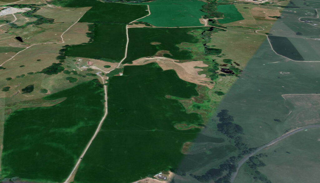
159 Okoroire Rd Tirau – Google Maps
South East Corner – Google Maps
North East corner (Bayleys block) – Google Maps
Tirau Beef Farm Videos
1 Central House area https://youtu.be/Bco4DljZPyQ
2 North West Sector https://youtu.be/Q1h5QgxQ84M
3 Central Western Area facing North across Waikato Farming region https://youtu.be/7UHi-Pr6gTo
4 North Eastern sector https://youtu.be/-1Lrov6O5Sw
5 South East Corner https://youtu.be/MkuzC4REZaI